The ultimate outdoor off road adventure

We get it – you’d love to see Fraser Island and Rainbow Beach in its entirety – which you can’t do unless you have an off road vehicle.

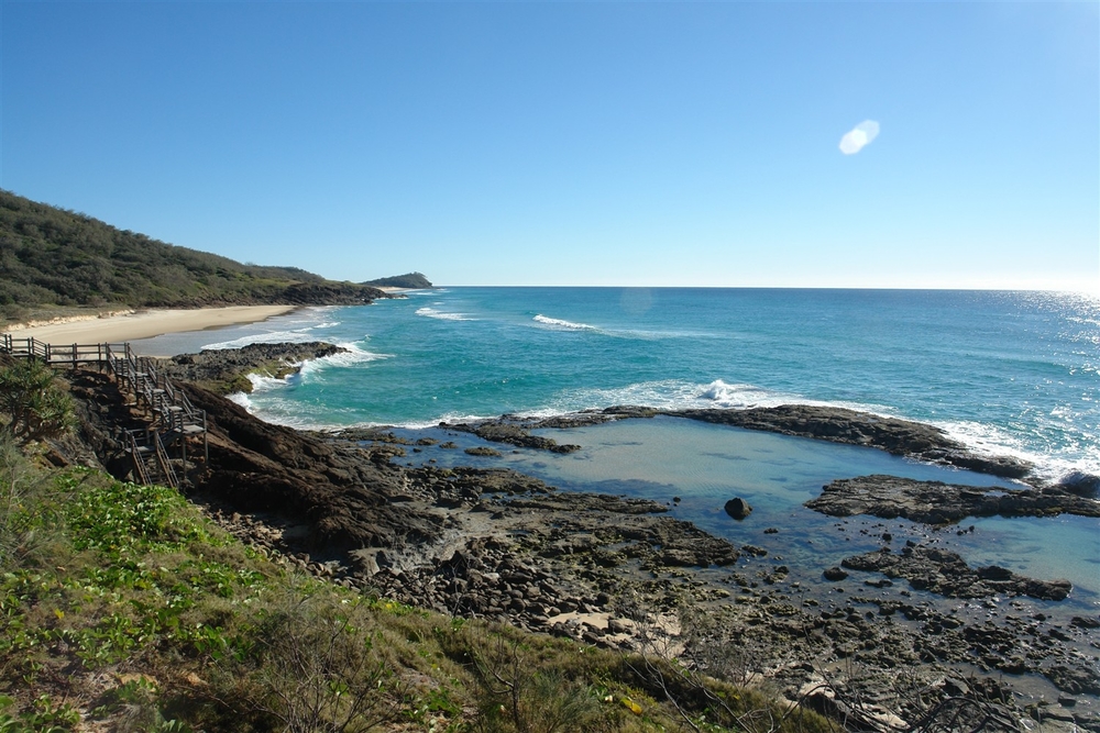
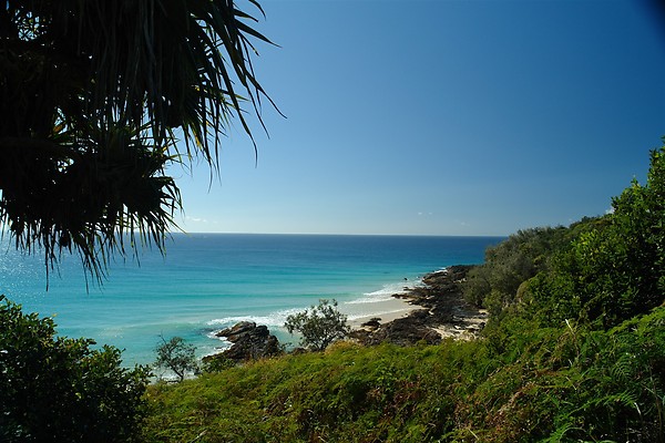
The Cooloola Coast is a veritable high suspension playground with perfect surf beaches, bush walking tracks, para-gliding and sky diving activities.  Swim with dolphins, dive with Grey Nurse sharks or take a plunge in the ocean on horseback discovering more than 200kms of beach trafficable coastline.  IT IS AMAZING.

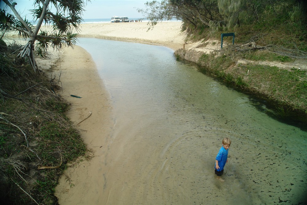
It’s not just about Fraser Island when it comes to beach driving.  You can also explore Noosa North Shore along the Sunshine Coast’s Teewah Beach destination Rainbow Beach.  The beach trip takes approximately 45 minutes and is gaining world-wide attention as one of the most spectacular things to do while holidaying in South East Queensland.  There really is no other place or opportunity like this one.  Either take your own vehicle, hire one or board the local shuttle service return from Maroochydore airport which also specialises in half day Rainbow Beach tours.

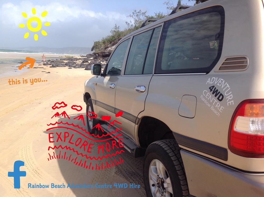
Rainbow Beach Adventure Centre 4WD Hire is a family owned and operated business and has been in the industry since 1999.  With that in mind we’d like to think we have half an idea when it comes to all things off road hire vehicles and service.  Most of our visitors have never been on Fraser Island and equally most have never driven a 4×4.  Many originate from central and northern Europe as well as north America and of course Australia and it has to be said people do have high expectations when visiting this incredible biosphere.  Well we can happily report we have never, and we mean never, had anyone say that they didn’t have one of the most amazing experiences of their lives.  It’s on the bucket list must for most.

We certainly know our vehicles and what they are capable of and ensure personalised itineraries, including our own maps with tidal information, are provided.  We also take our guests on individual driving demonstrations so that they are familiar with how the vehicle operates and the difference between engaging high range 2WD and 4WD and low range 4WD.  It is crucial that our guests understand the implications of driving at incorrect tidal windows with the noted guideline two and half hours either side of low tide generally provides beach trafficability up to six hours per day.  As far as untrafficability is concerned the reverse applies where two and half hours either side of high tide the beach is untrafficable.  In simple terms we provide beach ON and OFF times so relatively straight forward.  The vehicles’ tyres are also pre-deflated at 22psi providing our guests instant ease when accessing the soft sand.  Deflating tyres is also very important as this creates greater surface area in the tyre.  Even if engaged in low range 4WD the chances of going nowhere in a hurry on road pressure tyres is a certainty.

FRASER ISLAND FACTS

LOGGING HISTORY

Logging was started on Fraser Island in 1863 by ‘Yankee Jack’ Piggott and continued until December 1991 when the island was nominated for World Heritage listing.  The first trees taken by the loggers were kauri pine, hoop pine and cypress pine.

In the early 1900s hardwood species such as tallowood, blackbutt and brush box were targeted.

In 1925 satinay became the major timber logged on the island after it was found to be resistant to marine borer and became popular for use in marine conditions around the world.  Satinays, logged heavily in the Pile Valley area, were used to line the banks of the Suez Canal and to rebuild the London Docks after World War II.

Central Station, a former logging camp, is now a Queensland Parks and Wildlife Service ranger information station and interpretive centre.  Some of the old loggers’ houses are still there.  A walking track takes you to Wanggoolba Creek which is easily accessed by a board walk and the creek is home to the magnificent giant King Fern.  Further excellent examples of kauri pine, brush box, Fraser Island satinay and piccabeen palms can be found here.

STONETOOL SAND BLOW

This active mobile sand blow has covered a vast established forest area.  As the sand blow changes with wind direction it uncovers ancient forest as it moves across the island and takes its name from the Aboriginal stone tools found there.
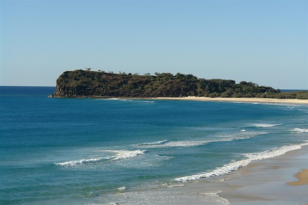
SEVENTY-MILE BEACH

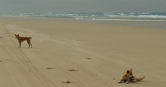
This spectacular gazetted highway on the eastern side of Fraser Island not only stipulates regular road rules but also requires right of way light aircraft landing at the landing strip at Eurong.  Plenty of birds of prey and sea birds migrate here throughout the seasons and of course the dingoes are a highly sought after photo opportunity.
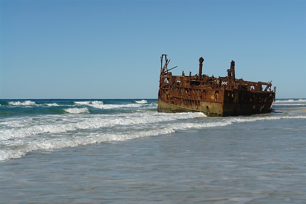
MAHENO SHIPWRECK

Built in Scotland in 1905, the luxury cruise ship Maheno sailed between Sydney and Auckland.  She was one of the first turbine-driven steamers and one of the fastest ships of her time, setting a record for the quickest crossing of the Tasman in 1907 (two days 21 hours).

During World War I she was commissioned as a hospital ship in Europe and also served in the Mediterranean and the Red Sea.  After the war the Maheno was recommissioned as a cruise ship.

On July 8 1935 while being towed to Japan for scrapping the Maheno was struck by an out of season cyclone and washed ashore.

During World War II the wreck was used for air force target practice and by Z Force special unit who practiced planting limpet mines on her prior to the raid on Singapore Harbour.
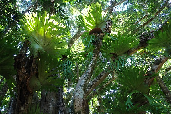
PLANT COMMUNITIES

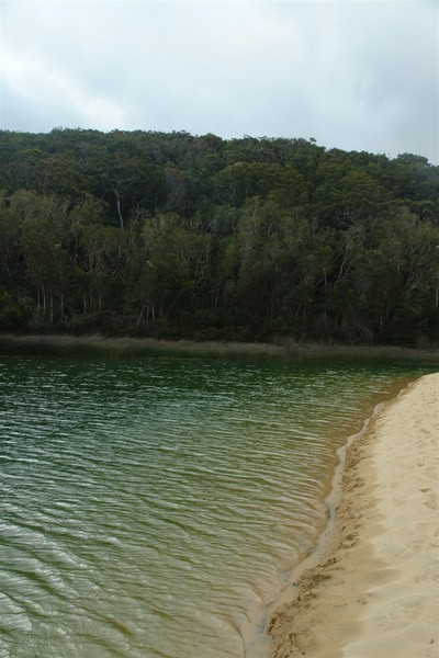
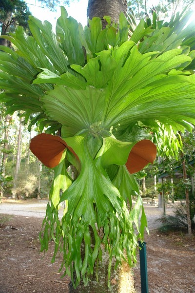
Fraser Island has a wide variety of plant communities growing in sand and ranging from coastal heaths to subtropical rainforests.  The plants find nutrients from thin coatings on the sand grains and from the decomposed leaf litter (humus) on the forest floor.

Coastal Heaths grow in the harsh conditions on the eastern side of Fraser Island and have to contend with strong winds, salt spray, sand blasting and limited fresh water.  These plants help to stabilise the sand and start the nutrient cycle.  Common plant species include beach spinifex, angula pigface and horsetail she-oak.

Eucalypt forests are found across most of Fraser Island.  Open scribbly gum forest dominates in the drier areas of the island.  The trees have pale bark covered in what looks like graffiti.  This is caused by moth larvae making shallow tunnels under bark which later peels off.  Tall blackbutt forests with an understorey of small shrubs are found in the wetter areas of the island.  Satinay and brushbox dominate the edges of rainforest in what is known as a transition forest.  The understorey often contains rainforest species.

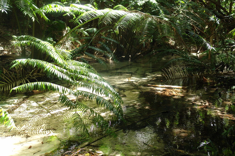
Rainforests grow on sand dunes at the world’s highest elevation being more than 200 metres.

Subtropical rainforest can be found in the centre of the island in the wetter gullies.  These communities have a thick canopy of leaves allowing minimal light to reach the forest floor.  This causes the trees to grow tall and straight to reach the sunlight making the trees suitable for logging.  Kauri pine and the piccabeen palm are common species found in the rainforests.

Wallum heath lands dominated by the wallum banksia and featuring sedges and grass trees are known for their colourful wildflowers which are in full bloom in spring.  Heath lands can be found on the drier ridges and high plains.

FAUNA

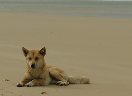
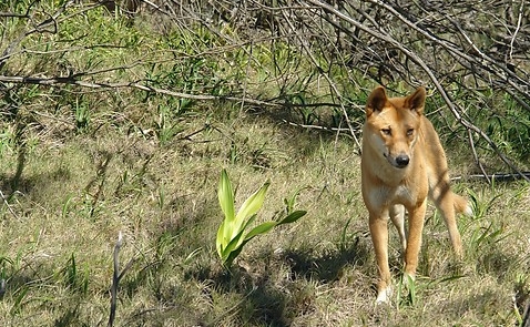
Fraser Island is home to many different animals, however, most are nocturnal and rarely seen.  The most obvious mammals on the island is the Dingo.  There are estimated to be 150-200 dingoes on Fraser Island living in all habitats.  Although they appear similar to a domestic dog they are closely related to the Asian wolf.  Dingoes on;y produce litter of about 4-6 pups each year in August.  Fraser Island’s dingoes are amount the most genetically pure dingoes in Australia.

There are 47 other species of mammals on Fraser Island including the swamp wallaby, small eared mountain possum and the sugar glider.

More than 350 species of birds have been sighted on Fraser Island.  The island has a wide range of habitats providing different food sources, nesting and breeding areas.  Fraser Island is also a resting and breedign ground for migratory birds some from as far away as Siberia.

Fraser Island is home to 79 species of reptiles including 19 snake varieties.  The most commonly seen reptiles are the sand monitor and the lace monitor.  These large lizards are often seen around the picnic areas looking for scraps.

Dolphins, dugongs, turtles, rays and between July and November migrating humpback whales frequent island waters.

Rare frog species such as the “acid” frogs which have adapted to survive in a difficult environment can be seen and heard in the swamps.

Fraser Island

Fraser Island is the largest sand island in the world, stretching over 123 kilometres in length and 22 kilometres at its widest point.  The highest dune is 244 metres but most rise to between 100 and 200 metres above see level.  Drilling has shown the sand extends to 100 metres below sea level in places.  Most of the sand comprises grains of quartz (silica), with less than two per cent being other minerals such as rutile and zircon.

WORLD HERITAGE

In 1972 UNESCO adopted the World Heritage Convention to protect special places for all  humanity. Fraser Island was listed by UNESCO in 1992 in recognition of its natural values.  The official citation pays tribute to the island’s exceptional natural beauty and refers to over “250km of sandy beaches with long, uninterrupted sweeps of ocean beach, with more than 40km of strikingly coloured sand cliffs, as well as spectacular dune blowouts, ocean surf beaches, spectacular tall rainforests growing on low nutrient sands, perched dune lakes including both clear white water lakes and dark black water lakes, banksia woodlands, heath, patterned swampy fens and sheltered mangrove areas in a spectacular mosaic landscape”.

Fraser Island provides a globally significant example of geological processes and biological evolution including complex coastal dune formations that are still evolving, an array of lakes that is exceptional in terms of number, diversity, age and the evidence of dynamic and developmental stages along with outstanding examples of ecosystems that have developed in response to maritime conditions and poor soils in coastal dune formations.

THE GREAT SANDY STRAIT

Separating Fraser Island from the mainland the Great Sandy Strait is listed by the Convention on Wetlands of International Importance.  The wetlands include rare patterned fens, mangrove colonies, sea-grass beds and up to 40,000 migratory shorebirds.  Rare, vulnerable or endangered species include dugongs, turtles, Illidge’s ant-blue butterflies and eastern curlews.

THE FORMATION OF FRASER ISLAND

The shifting sands of Fraser Island and those of nearby Cooloola, have continually concealed and revealed a unique geological history.  The dunes have the longest and most complete age sequence of coastal dune systems in the world.

While most of the sand that makes up Fraser Island has come from the far south-east of Australia, some of it has travelled for thousands of kilometres and millions of years from Antarctica, starting its journey before landforms Australia and Antarctica were separated from each other.

Mobile sand blows formed by the prevailing south-easterly winds, progress across the island often burying forests and other plant communities.  The rate of movement of the dunes each year depends on factors such as wind strength, the amount of moisture in the sand and plant colonisation.

ROCKY OUTCROPS

There are three rocky outcrops of igneous rock from volcanic activity on the island.

Indian Head is the most prominent landmark on Seventy-Five Mile Beach.  The 60-metre high rocky bluff, shaped rather like a whale, is a spectacular viewing platform.  You can often see birds of prey resting on the cliff tops and sharks and stingrays swimming in the clear waters below.

Middle Rocks contain the largest true rock pools on the island being Champagne Pools, also referred to as The Aquarium.  They form superb natural fish traps and were used as such by the Aboriginal people.  Washed by waves at high tide, the bubbling sea water makes them excellent swimming holes.

Waddy Point is the northern-most outcrop.

EUROPEAN HISTORY

Fraser Island was first sighted by Captain James Cook in 1770 while travelling up the east coast of Australia.  Captain Cook named the island “Great Sandy Peninsula” in the mistaken belief it was connected to the mainland.

In 1799 Matthew Flinders in the ‘Norfolk’ explored parts of Hervey Bay and discovered the peninsula was in fact an island.

In 1836 Captain James Fraser on the brig ‘Stirling Castle’ was wrecked at Swain’s Reef, north of Fraser Island.  The survivors travelled south in a life boat and eventually found themselves marooned on Fraser Island.  Of them, only Eliza Fraser, the wife of Captain Fraser, survived.  Europeans named the island after Captain James Fraser.

ABORIGINAL HISTORY

The Butchulla people are the indigenous people of Fraser Island.  The tribal lands of the Butchulla extended from Burrum River in the north, south to Cooloola National Park and west to Mount Bauple.  The Butchulla people’s name for Fraser Island was k’gari, pronounced Gurrie, which means paradise.

The Butchulla tribe consisted of six clans, giving permanent population of about 700.  This population increased to around 2,000 during winter when other tribes would visit to feast on fish such as tailor and mullet.  There are now few living descendants.


View from a hill on K'gari (Fraser Island) of a rocky beach, impassable by 4wdThe shifting sands of Fraser Island and those of nearby Cooloola, have continually concealed and revealed a unique geological history.

View our rates page for information on hiring your own self-drive 4wd to explore K’gari (Fraser Island) or fill out an enquiry/booking form.

Lake Wabby

Lake Wabby is surrounded on one side by the massive Hammerstone Sand Blow and on the other side by eucalypt forest.  This is an example of a barrage lake, formed when a creek became blocked by a shifting sand dune causing the water flow to be dammed.  Its emerald green waters are home to 13 species of fish.  Access by foot from the eastern beach is 45 minutes.


Lake Wabby, emerald green in colour is unique to Fraser Island.

Lake Wabby, emerald green in colour is unique to K’gari (Fraser Island).

Indian Head

This volcanic outcrop is the only rock formation on Fraser Island jutting out approximately 200ft above sea level and lies approximately 95kms north of Hook Point (ferry access point via Rainbow Beach).  Sailing past in 1770 Captain Cook named it Indian Head as he observed native Aboriginals on its peak.  Today it continues to be a vantage point for fishermen (hunting in the protective waters the rock provides for prey) as well as keen sightseers wishing to glimpse migrating humpback whales between August and November (heading north from the antarctic to have their young in the calm waters of Hervey Bay).


The only rock formation on Fraser Island Indian Head provides an excellent lookout vantage point.

The only rock formation on Fraser Island Indian Head provides an excellent lookout vantage point.

Wanggoolba Creek

Thirty minutes inland at Central Station awaits the magical experience of Wanggoolba Creek.  A twenty minute walk along the purpose built board walk allows visitors to marvel at the slow flowing crystal clear freshwater introducing a number of species of fish, turtles and eels.  Flora lovers will enjoy stopping at the viewing platform of the Angiopteris evecta King Fern growing directly in the creek, its root structure supported by the water (due to its primitive origins).  This specimen is extremely rare and cannot be found anywhere else on Fraser Island, providing a unique opportunity to observe prehistoric plant life.  Those with more time can continue to Pile Valley and Lake McKenzie for the full walking experience deep into the tropical rainforest.

As Fraser Island’s creeks flow silently over sandy beds, they spring from a huge underground acquifer which holds about 30 times more water than Sydney Harbour.  The creek water remains at a reasonably constant temperature of 18 degrees celsius.  Hundreds of creeks spill over the beaches of Fraser Island one of the biggest and most beautiful being Wanggoolba Creek which flows from the rainforest near Central Station to the west coast of the island, south of Kingfisher Bay Resort.


Wanggoolba Creek at Central Station gives you an idea of how pristine this environment actually is.

Wanggoolba Creek at Central Station gives you an idea of how pristine this environment actually is.

Eli Creek

Eli Creek is the largest freshwater creek flowing freely out on to Seventy-Five Mile Beach at a rate of approximately 4.2 million litres of water every hour.  Situated on the east coast of Fraser Island, north of Happy Valley it provides the ideal freshwater dip and exploration opportunity.  A timber walk-way and bridge make for easy access and is extremely popular with day trip visitors.


The largest of freshwater creeks flowing into the Pacific Ocean is Eli Creek - excellent spot for a cool water dip.

The largest of freshwater creeks flowing into the Pacific Ocean is Eli Creek – excellent spot for a cool water dip.

The Maheno Shipwreck

The SS Maheno, a shipwreck on Seventy Five Mile Beach at Fraser Island connects Australia and New Zealand with the ANZAC’s at Gallipoli.  ANZAC Day was borne out of the campaign on the Gallipoli Peninsula in 1915 when the Australian and New Zealand armed forces combined their efforts to overrun the Turkish army.

While the campaign did not achieve the intended goal the conduct of the ANZAC’s indelibly shaped the Australian and New Zealand nations.

Before her tours of duty the Maheno was owned by the Union Steamship Company of New Zealand and more significantly for 2015, it marks the centenary of the landing at Gallipoli, as it was the New Zealand Hospital Ship Maheno (NZHS Hospital Ship No 1) in WWI.

The New Zealand Hospital Ship Maheno collected both Australians and New Zealanders from ANZAC beach in 1915.  After the withdrawal from Gallipoli and for the duration of WWI the Maheno collected the wounded of all nationalities from the major battle fields of France and transported them to Britain for further care.  So many owe their lives to the dedication and efforts of the medical teams and the hospital ships including the Maheno.

The SS Maheno, launched in 1905 operated as a passenger ship primarily on the cross Tasman run between Australia and New Zealand.  The Maheno held the speed records for almost two decades.  Following the start of WWI, the Maheno was chartered by the New Zealand government and converted to be HMNZ Hospital Ship No 1.  Much of the medical equipment on board came from public appeal.  The first voyage of the Maheno as a hospital ship was from 7 July 1915 to 1 January 1916, arriving at ANZAC beach in Gallipoli for the first time on 26 August 1915.  Normal service duties resumed after the war.

On 3 July 1935 the Maheno left Sydney under tow after having being sold to a Japanese shipbreaker.  On the afternoon of 7 July while about 50 miles from the coast the towline parted during a severe cyclone.  Attempts to reattach the towline failed in the heavy seas and the Maheno with eight men aboard drifted off and disappeared.  The Oonah, the former Bass Strait ferry towing the Maheno and also destined for the Japanese shipbreaker, broadcast a radio message requesting assistance for the Maheno, whose propellers had been removed.

The ship was finally found on 10 July by an aircraft piloted by Keith Virtue beached off the coast of Fraser Island.  The crew of the Maheno set up camp onshore, waiting for the Oonah to arrive, which it eventually did on 12 July. The ship was subsequently stripped of her fittings but attempts to refloat her failed and eventually the wreck was offered for sale but found no buyers.

The SS Maheno is named after a small New Zealand community between Dunedin and Christchurch.  The original SS Maheno ship’s bell has hung at the Maheno (Primary) School in New Zealand since 1967.  The bell was removed before the ship was sold to be scrapped and retained by the former owners of the ship Union Steamship Company of New Zealand until the bell was donated to Maheno School.

And so the gallant shipwreck of the SS Maheno has been resting on the eastern beach of Fraser Island since 1935.  No doubt many have memories of its early landing and the subsequent ‘land mark’ it created.  It has been the subject of many an avid photographer with literally dozens of postcard designs having been produced over the years.

One of our facebook fans, Steve Gilbert, recalls fond childhood memories clambering over the wreck on his Fraser Island camping holidays.

“Great memories of that ship. It had 3 levels when I was a kid and we camped on the beach next to it. I knew every inch of it lol.”

Thanks Steve for your insight…what a fantastic adventure, camping AND a shipwreck, Ahoy Matey!


The SS Maheno - shipwrecked on Fraser Island since 1935.

The SS Maheno – shipwrecked on Fraser Island since 1935.

Fraser Island Dingoes

Fraser Island Dingoes are acclaimed as one of the purest breeds on Australia’s eastern seaboard.  They are wild animals and should be admired from afar.  They look cute but can become dangerous if guidelines provided by Department of National Parks (Queensland Government) are not adhered to.


Taking a rest.

Taking a rest.

Queensland Parks and Wildlife Service warning:

Some dingoes are dangerous because people have fed or encouraged them.

Be dingo-safe!

  • Always stay very close (within arm’s reach) to children, even small teenagers.
  • NEVER feed dingoes.
  • Walk in groups.
  • Bin all rubbish and secure food.
  • Know what to do if a dingo approaches.

In the scrub.

In the scrub.

It is an offence to feed or make food available to a dingo, or intentionally attract or disturb a dingo anywhere on Fraser Island, whether on public or private land.  Never leave food or rubbish unattended.  Remove plates and scraps from tables, keep food and rubbish in strong lockable containers, keep iceboxes and picnic containers in your vehicle when not in use and never take food or drinks, except water, to lake shores.  Penalties apply.

Double trouble.

Double trouble.

Central Station Rainforest

Magnificent Staghorn specimen - Central Station, Fraser Island

Magnificent Staghorn specimen – Central Station, Fraser Island

Only thirty minutes inland from Eurong Beach Resort lies Central Station.  So named as logging families built their housing and school here in the 1920’s – well before the island was heritage listed.  Today it is a majestic public camp ground with all the trimmings.  Its location is ideal as it offers the best vantage point to Lakes McKenzie and Birrabeen as well as Wanggoolba Creek, home of the giant King Fern.  Further breathtaking specimens of kauri pine, brush box, Fraser Island satinay and piccabeen palms are also found in this area.

This tropical rainforest area includes unmanned information displays explaining the history of the island, its development and of course various forms of flora and fauna, some unique to the micro-climate of Fraser Island.

Close up of bug on a Staghorn tree fern - Fraser Island

Close up of bug on a Staghorn tree fern – Fraser Island

Staghorn and Elkhorn tree fern canopy - Fraser Island

Staghorn and Elkhorn tree fern canopy – Fraser Island

Champagne Pools

Just north of Indian Head lie stunning Champagne Pools.  Safe for swimming (beware of water breaking over the volcanic rock barrier) a timber stairway leads down to these natural water havens.  Panoramic views make for a must see destination.


A stairway to heaven - Champagne Pools offer safe beach side swimming holes.  Beach swimming anywhere else is not recommended - rips and undercurrents are too dangerous.

A stairway to heaven – Champagne Pools offer safe beach side swimming holes.  Beach swimming anywhere else is not recommended – rips and undercurrents are too dangerous.